


Preferred Street view camera & workflow13318
Pages:
1
 WGAN Fan WGAN FanClub Member Buffalo, New York |
GETMYVR private msg quote post Address this user | |
| Just curious what your preferred camera is for Google Street view and what software works best to connect to maps in 2020 and beyond? | ||
| Post 1 • IP flag post | ||

|
PickChuck private msg quote post Address this user | |
| @GETMYVR I am using the Z1 and having good success with it. I was one of the first Google TIP’s when we shot DSLR’s and each shoot had to be approved and we did our own editing on stills and moderated the Panos. |
||
| Post 2 • IP flag post | ||

|
TakedaSan private msg quote post Address this user | |
| Hi @GETMYVR, What I see the most and what I use is DSLR cameras with fisheye lens, as they have the highest quality. And Panoskin to build Google tours. https://www.panoskin.com/google-street-view-editor I am also one of the first in Brazil to publish tours to Google Street View. Jefferson Takeda IMG360.com.br |
||
| Post 3 • IP flag post | ||
|
|
PickChuck private msg quote post Address this user | |
| @TakedaSan I am saying it’s a new day on the Google shoots in my opinion. That’s why I am recommending the Ricoh Z1 for the Google shoots. The more efficient and cost effective I can be the more I can shoot and the more money stays with me. Example: Z1: 1 shot in each location, use in camera HDR, use touch retouch to get rid of nadir (which is not really necessary- Google only blurred the tripod legs), use the street view app for upload. All done on an iOS device. Or Example: DSLR: Shoot bracketed shots at 4 points around at each location (minimum 12 shots), bring into Lightroom and merge and create HDR images and color correct, export to PTGui and build panos, export and P2VR and edit Nadir. Go into your favorite pano product that has an output to Google. Create you tour and upload. Just my 2 cents worth. The older and hopefully a tiny bit wiser I look for ROI (Return on investment) both on my money and time. Respectfully, Chuck |
||
| Post 4 • IP flag post | ||

|
SiteTour360 private msg quote post Address this user | |
| @GETMYVR - It depends a lot on what type of Street View work your doing. The great news nowadays is that there are lots of cameras and software platforms out there for publishing to GSV. The above mentioned choices are all good for publishing the traditional see inside style tours. We publish a lot of larger area blue line collections for apartment complexes, subdivisions and shopping centers, mainly to update Google Maps etc, anywhere from 1 to over 100+ miles...if your wanting to do something like that you should look into GoProMax, LabPano/PilotEra, insta 360 pro2 or NCTech istar Pulsar for hardware and then pick the best publishing platform for the camera. GoThru’s StreetBuilder is good all around choice for that. | ||
| Post 5 • IP flag post | ||
 WGAN Forum WGAN ForumFounder and Advisor Atlanta, Georgia |
DanSmigrod private msg quote post Address this user | |
| Video: Pilot One Enhanced Edition + replacement guide | Video courtesy of Ivan Alchimista | 14 October 2020 Video: Meet Labpano family members-Pilot series cameras are all here | Video courtesy of Labpano YouTube Channel | 15 October 2020 @GETMYVR Short Answer ✓ Labpano Pilot Era camera or Labpano Pilot One EE (not the original) (publish directly to Google Street View) ✓ Panoskin Pro (if you use any other 360 camera for capture) Longer Answer ✓ 2020 is the year of Google Street View Blue Line Map Updates by Pros [published before pandemic] ✓ Labpano Pilot One + GPS Module + Backpack = Google Street View Blue-Line ✓ 10 Backpacks to pair with 360º Cameras to create Google Street View Best, Dan P.S. If you decide on the Labpano Pilot One EE: careful not to buy the now recalled Labpano Pilot One [Labpano has done a smart thing offering to replace the original Labpano Pilot One with a version that includes the GPS built-in, heat dispersion shell instead of mechanical parts of built-in fan. |
||
| Post 6 • IP flag post | ||
|
WGAN Forum Founder and Advisor Atlanta, Georgia |
DanSmigrod private msg quote post Address this user | |
| @GETMYVR As a WGAN Standard Member, you receive the free use of Panoskin Pro (WGAN Order Form) Dan |
||
| Post 7 • IP flag post | ||
|
|
ron0987 private msg quote post Address this user | |
| As for work flow has anyone found software that when your project is uploaded that the project merged into the existing blue line. I update apartment complex street. The existing street view was updated but now the new model did not tie into the next street even though I took photos out to centerline of existing blue line. | ||
| Post 8 • IP flag post | ||
|
|
PickChuck private msg quote post Address this user | |
| @DanSmigrod Thanks for the post about the Pilot One. The updated one looks like a great camera. I guess the thing I like about this forum is the great share of information and interaction between users. I learn something every time I log in. There are many ways of doing 360's and the industry is evolving very fast. So exciting to see this. Not only are the cameras evolving but the platforms are going great guns too. I don't know of any other resource better than this forum for 360 information on the web. Thank you for all you do for us and this community. Chuck |
||
| Post 9 • IP flag post | ||
|
WGAN Forum Founder and Advisor Atlanta, Georgia |
DanSmigrod private msg quote post Address this user | |
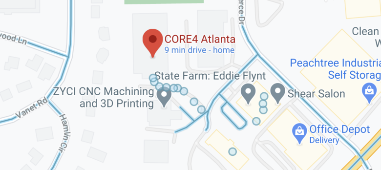 Screen Grab: Google Maps | Street View @ron0987 I am having the identical issue here. (screen grab above) In this screen grab (above), you can see the "blue-line" dots that we added to Street View. I shot it so that my addition crosses the path of the existing "blue-line". Unfortunately, the two do not connect. I wonder if eventually, Google Street View will recognize this overlap and connect the dots! Hoping someone reading this discussion will have a (positive) result/answer to our challenge. Best, Dan P.S. The good news is that we did not promise the client that the two would connect (given what we have read on this topic). |
||
| Post 10 • IP flag post | ||
|
WGAN Forum Founder and Advisor Atlanta, Georgia |
DanSmigrod private msg quote post Address this user | |
| @PickChuck Thanks Chuck. It takes the Community to make that all possible. Any thoughts about: Quote: Originally Posted by @ron0987 Dan |
||
| Post 11 • IP flag post | ||
|
|
ron0987 private msg quote post Address this user | |
| @PickChuck I totally agree great resource. | ||
| Post 12 • IP flag post | ||
 Matterport Matterport Camera Repair Service Gainesville, Florida |
MatterFix private msg quote post Address this user | |
| @DanSmigrod - the only way to insure that you get blue line is to capture in the GSV video mode and upload directly, or convert a video file that has GPS data in it to individual geo-referenced panoramas using a program like StreetBuilder, then upload to GoThru or PanoSkin Pro and publish to GSV. Even with publishing one of these ways to GSV, it is very hit-or-miss on whether it will connect to Googles existing blue line. | ||
| Post 13 • IP flag post | ||
 WGAN Fan WGAN FanClub Member Queensland, Australia |
Wingman private msg quote post Address this user | |
| a Z1 will be great if you do inside view where precise location data is not required and cannot be actually captured(considering it is indoor capture). However if you have a job with a lot of outdoor capturing and you need correct location data in your panos in order to place them correctly on google maps you will regret using Z1/V. Their Theta app screws location data making a 5 meter precision to something like 50m and more. It happens because some code in the app somehow ruins decimal precision for location stored in a pano EXIF data. It does not happen if you do not use the Theta app and only capture with the Street View app. However this way you won't be able to use any plugin including Timeshift one. And like Dan has mentioned above a Pilot One is also an option. And I believe it is much better than a Z1 in any way.. not to mention that it provides more resolution. Labpano has announced recently that they rebuilt their Pilot One and their new enhanced version of Pilot One comes with a GNSS module built in. I do not know if it affects the current price of Pilot One. If it is not it is not that much over a RRP of a Z1. As for building I use Pno2VR pro and it is great not just for publishing or editing GSV tours but you can use it to build a custom interface and self hosted virtual tours. |
||
| Post 14 • IP flag post | ||
|
|
PickChuck private msg quote post Address this user | |
| @Wingman You make great points on all of this. You are very knowable sir. It seems like all these 360 cameras have a particular niche. I haven't found one that does it all. Perhaps it's just their "master plan" to make us buy several of them For me as primary a Real Estate photographer shooting stills as my main offering the 360's as well as Drone work are an "Add On". A bit of background: I can shoot "Traditional 360's" but quit shooting them for Real Estate and cut back my Google shooting because of the race to the Bottom price wise. Of course there is a quality difference and I accept that. I am using the Z1 to promote my Real Estate photography by being one of the only ones around here doing Zillow Panoramas. Something that can not be done currently with the Pilot One. I think eventually I'll end up with several 360 cameras. - Z1 for Zillow, simple inside Google Trusted shoots and Small houses (Shooting in camera HDR) - Z1 for larger houses using either Ricoh app with bracketing or Dual Fisheye and using Gigapixel, PtGui and Asteroom as my processing suite - Z1 for shooting for Threshold (They are a 360 Marketing company and that's their camera of choice) - Pilot ERA if I can figure out how to make money with blue lines and bigger shoots (I will have to justify this for sure. Maybe look into Metareal and Box Brownie for these. This might be something that could set me apart. Each tier should have a quality and associated price increase with it. Again, my two cents worth. It is exactly worth what you paid for. Cheers, Chuck |
||
| Post 15 • IP flag post | ||
Pages:
1This topic is archived. Start new topic?