


Realsee Galois P4: Field Demo Scanning Buildings and Point Clouds21643
Pages:
1
 Owner, Owner,Managing Editor and Publisher of WGAN Forum and WGAN-TV Podcast Fairfield, California |
TomSparks private msg quote post Address this user | |
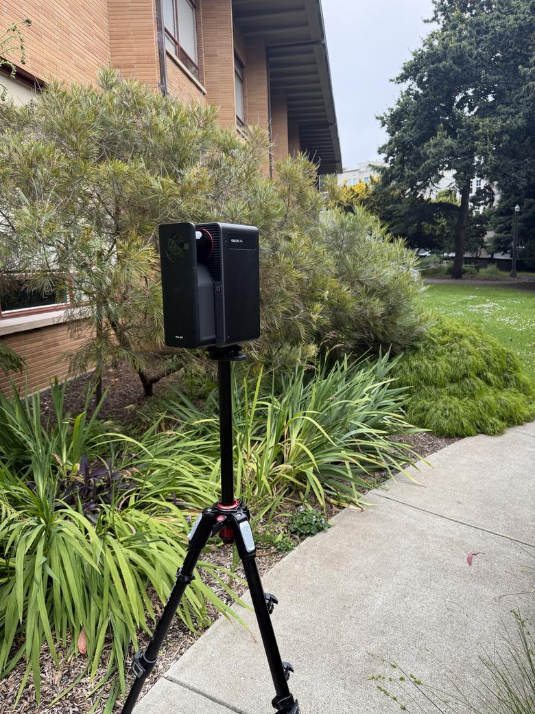 Realsee is a We Get Around Network Marketing Partner Realsee Galois P4: Field Demo Scanning Buildings and Point Clouds Published by: We Get Around Network Yesterday I brought the Realsee Galois P4 to a municipality GIS department to demo what it can do on real buildings, not a staged showroom. We scanned a basement annex, a stairwell, and the exterior grounds so they could see the capture quality, the speed, and the kind of data files they would get back. This is a team that cares about accuracy because their downstream work depends on it, so this was a good test of whether the P4 holds up for serious building documentation. The image quality is the first thing that landed. Looking at the raw scans on the app, before any processing, the GIS lead said it looked better than the tours he had seen in the past. When we clicked into a single scan point under a park bench outside, the team called the detail almost photo quality. The P4 is LiDAR based, so it moved from an overcast exterior into a dim interior basement without the sunlight problems older infrared cameras run into. One exterior scan point alone pulled in a surprising amount of the surrounding grounds, and you could clearly see the slope of the ground rise as we walked up the ramp. The capture is fast and consistent. Each scan runs about sixteen to seventeen seconds, and we covered the basement annex in roughly thirty minutes even while stopping constantly to talk. The estimate was that the entire annex could be done in about half a day. The P4 also captures app free, so when I accidentally closed the app mid job, I switched to blind capture, kept scanning with the button on the camera, and imported those scans back in seconds with perfect alignment. With 512GB of onboard storage, that matters on large buildings or hot rooftops where a phone overheats and slows you down. What this team really wanted to understand was the data, and that is where the P4 earns its place. The E57 point cloud export runs about $60, cheaper than the Matterport equivalent, and you own the file to hand off to a scan to BIM or scan to CAD firm for whatever level of detail you need. We talked through how a colorized point cloud plus the panoramas gives you both the measurable data and the visual reference in one capture, which is exactly what gets lost when a firm delivers a point cloud with no usable imagery. The P4 captures 125,600 measurements per second, and the walls, pipe runs, and wall widths all came through clearly enough to be useful for documentation, not just a pretty tour. For anyone doing building documentation, the cost and licensing math is worth noting. Hosting runs roughly one credit per tour per month, archivable for free when you do not need a tour live, with no closed enterprise lock in and no separate software license just to convert your files to E57. Compare that to the terrestrial systems where the camera is only the start and the annual software seat costs thousands. For 3D tours, accurate point clouds, and clean data files, the P4 covers a lot of ground from a single scan. Try Realsee (special pricing for WGAN Members): https://wgan.info/realsee use promo code WGAN for $300 off. About Realsee: Realsee makes the Galois P4, a LiDAR-based 3D capture camera for virtual tours, point cloud export, and building documentation. It is positioned as an alternative to Matterport for real estate, commercial, and facility capture. Topics covered in this demo include: Realsee Galois P4, LiDAR scanning, point cloud, E57 export, scan to BIM, scan to CAD, building documentation, image quality, app free capture Have you used the Realsee Galois P4 for commercial or building capture? Share your experience in the comments below. |
||
| Post 1 • IP flag post | ||

|
Realwalk3D private msg quote post Address this user | |
| Hi, I'd like to see this scan as a product, as separate 360 panoramas, and as a point cloud. Could you provide this data for me to review? |
||
| Post 2 • IP flag post | ||
Pages:
1