


[R&D] Mapping for GSV during vacation trips8163
Pages:
1
 Tosolini TosoliniProductions Bellevue, Washington |
Tosolini private msg quote post Address this user | |
| I just returned from a trip in Italy where I brought along my Insta360 Pro to do some experiments of Google Street View (GSV) mapping around my hometown Trieste. Google cars have done a very good job in my area, but there are plenty of pedestrian streets that haven't been captured yet. My goal was to identify a fast workflow to do some GSV-ing with minimal equipment to carry along. My final setup ended up being a small backpack containing my Insta360 Pro attached to a monopod and the GPS tied to it. 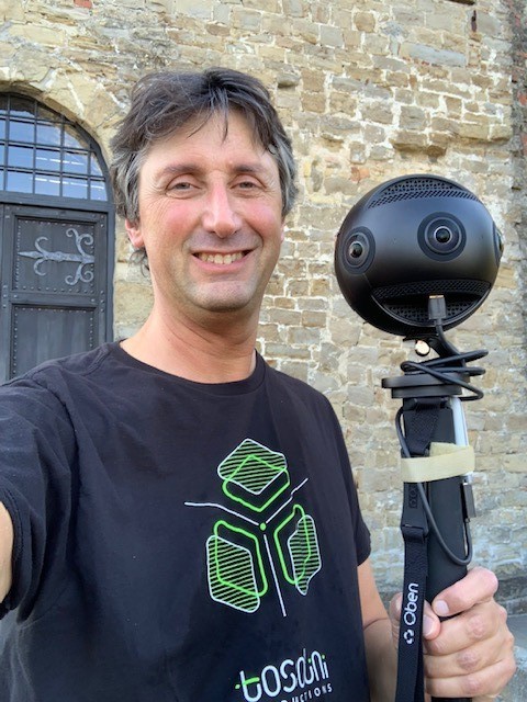 With the help of some friends and local authorities, we mapped the exterior of a castle, a new parking lot, university campus and old town. Here are some learnings from these experiments: - The capturing was a fairly straightforward process. I used my iPhone to start / stop the camera and I limited each recording segment to around 7-10 mins (at 5 FPS that means 3-5GB of 360 video to upload) - When we recorded in open areas, the GPS signal was strong, and the processing of the data into a GSV blue line took around 48h. The recordings in the alleys have not converted into a blue line after 10 days, which means GSV has some difficulties connecting the images - We tried mapping the interior of a building using the same technique of the exterior, and it failed completely. Google can't match the nonexistent GPS signal with the images - I carried with me a spare battery but never got to use it. - I'm not sure if strapping the GPS on the monopod had a negative effect compared to attaching it on top of the camera. - I'm unclear if GSV aligns the horizon automatically, as in some of my tours it hasn't happened yet after several days All in all, it was a good R&D process which didn't consume much of my time. Had I brought my MP camera along, I would have had to coordinate access to building interiors ahead of time. With the Insta360 Pro, there are plenty of opportunities to publish new content, especially if you don't mind walking around with plenty of people wondering what you are doing. |
||
| Post 1 • IP flag post | ||

|
SiteTour360 private msg quote post Address this user | |
| Hey Paulo - nice vacation spot! I have noticed mixed results with Google applying leveling to SV panos captured with the Pro...the capture below was very crooked when posted but is pretty good now...it took a week or more. Other times they have never been leveled. Best to try and collect with camera as level as possible. As to the placement of the gps unit...I have not noticed much difference when placed above or below the camera, however I have found that using velcro to attach to top of camera works well. https://streets.app/2ALBbl7 |
||
| Post 2 • IP flag post | ||
|
Tosolini Productions Bellevue, Washington |
Tosolini private msg quote post Address this user | |
| @sitetour360 thanks for the reply. I guess moving the GPS up / down by a few centimeters may not make such a difference. I see you are using a backpack instead of holding the camera like I did. Did you custom make it from scratch or ordered one that you could just slightly modify? Regarding the settings, did you find any that worked better than others? I went for default and I was pleased with the results. |
||
| Post 3 • IP flag post | ||
|
Tosolini Productions Bellevue, Washington |
Tosolini private msg quote post Address this user | |
| By the way, your footage of the aftermath of Hurricane Michael on Mexico Beach is impressive. You were able to capture such devastation in high detail using the NCTech iStar Pulsar. The quality of the images is much better than the Insta360 Pro. | ||
| Post 4 • IP flag post | ||
|
|
SiteTour360 private msg quote post Address this user | |
| Thanks for the feedback on the Pulsar pics! We got close to 3 million views on them already! Here's some pics of the backpack I've adapted...it's on Amazon[/url] https://www.amazon.com/ALPS-OutdoorZ-Commander-Frame-Only/dp/B004R7L17I/ref=sr_1_3?ie=UTF8&qid=1541439741&sr=8-3&keywords=backpack+frame I like the option to add branding as you can see. I would also recommend a ball head mount so you can fine tune leveling for specific person using the pack....it varies for different body types. If you want help getting one together it is pretty simple...I can send you the custom aluminum pieces that you could assemble yourself (at cost + shipping)....overall it's very functional. 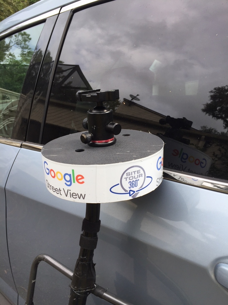 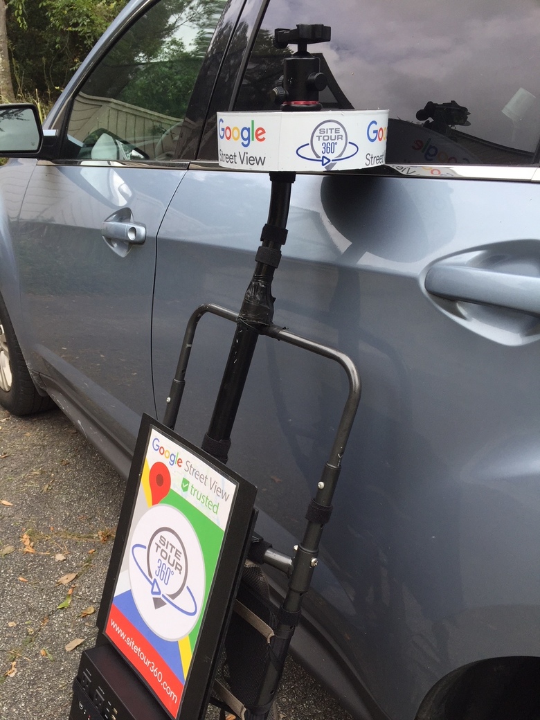 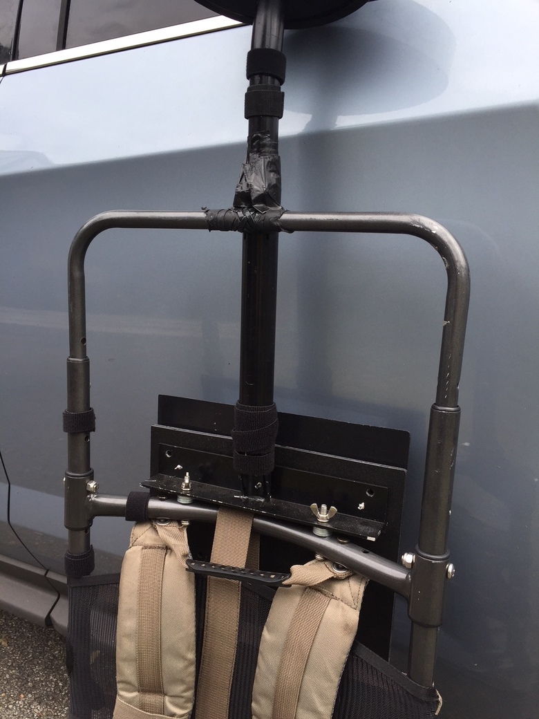 |
||
| Post 5 • IP flag post | ||
|
Tosolini Productions Bellevue, Washington |
Tosolini private msg quote post Address this user | |
| SiteTour360 Excellent marketing and custom setup. Thanks for the photos and links, I'm impressed by your overall organization. | ||
| Post 6 • IP flag post | ||
Pages:
1This topic is archived. Start new topic?