


Explainer: What exactly is Scan-to-BIM today?16488
Pages:
1
 WGAN Forum WGAN ForumFounder and Advisor Atlanta, Georgia |
DanSmigrod private msg quote post Address this user | |
WGAN-TV | Matterport + Leica BLK360: 20 Questions (and Answers) | Guest: Robotic Imaging Co-Founder Mike Chawaga | Aired: Thursday, 4 November 2021 | Episode 124 | Website: www.RoboticImaging.io Leica BLK360 Camera/Scanner (pairs with Matterport Capture App)  www.RoboticImaging.com The following article is reprinted with the permission of Robotic Imagining Co-Founder Mike Chawaga (@MikeChawaga). What exactly is Scan-to-BIM today? Let's start with Scanning. Scanning is done by Field Technicians using cameras and/or lasers on drones and/or tripods. Scanning is primarily used to rapidly collect existing conditions and to draft as-built documents accurately, fast and with more detail. The most accurate scan today is a scan with LiDAR. You can think of LiDAR as spherical lasers that capture millions of distances, color values and points per second, measuring and drawing a 3D picture. LiDAR scanners can be adjusted at different Levels of Detail (LOD). It is important to know exactly what LOD is needed prior to the scan. Laser Scanner quality is important to get the correct data. We now carry the Faro series with 350 meter range in combination with the Leica series - RTC360 Laser (LiDAR) Scanner below. 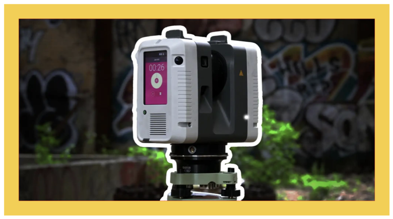 Image courtesy of Robotic Imaging After the field scan, the data goes through Registration: This requires manual QA, software experience and the correct computing. Your CPU is more important than your GPU when you are just concerned with geometic LiDAR production. You will need to increase graphics and particularily video memory when you are adding images or a lot of color to a lidar background. We prepare or “register” our data in Programs like Leica Cyclone and Faro Scene converting to BIM Software, such as, Autodesk Revit, AutoCAD, ArchiCAD or Bentley Microstation. If working on a large coordination project across multiple trades, this is the stage where you want to collect all design and estimation software and version. Greyscale point cloud registration in Register360 below. 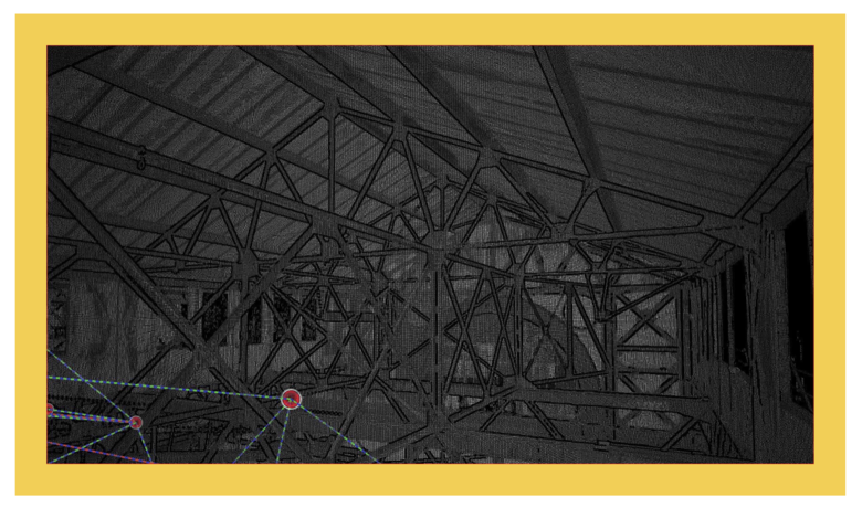 Image courtesy of Robotic Imaging Lastly, is Building Information Modeling which is the creation of 3D models pertaining to the scan. Currently BIM is being used for: 1. pre-construction 2. planning 3. simulation 4. coordination 5. documentation (historical) 6. estimations / take-offs 7. and real estate operations / facilities management (rare) Your BIM Model will eventually show you how your real estate is performing and how to optimize it throughout the asset lifecycle. When it comes to the digitization of assets you want close the virtual and physical gap with sensors and systems. 3D Revit Model below. 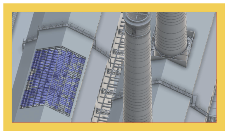 Image courtesy of Robotic Imaging What we typically include with Scan-to-BIM? 1. Virtual Reality 2. LiDAR Point Cloud in any BIM design software 3. Drone Map 4. 2D Plans, Elevations, RCP, Roof, Site Plans 5. 3D Model: LOD200-400 6. Data Storage, Maintenance, Optimization View Robotic Imaging Process --- Source: The above article is reprinted with the permission of Robotic Imagining Co-Founder Mike Chawaga (@MikeChawaga). --- WGAN Forum Related Discussions ✓ Transcript: WGAN-TV | Matterport + Leica BLK360: 20 Questions (and Answers) ✓ WGAN Forum discussions tagged: BLK360 | LiDAR | BIM | AEC | Robotic Imaging |
||
| Post 1 • IP flag post | ||
Pages:
1This topic is archived. Start new topic?