


DroneDeploy New Product: 360 Tours for Construction13308
Pages:
1

|
EaglePrecision private msg quote post Address this user | |
| I'm attending the DroneDeploy virtual conference where they just announced some new products. Check this one out - 360 tour documentation for construction: clickable text Not a lot of details yet but an interesting new offering for 360 tour providers. DroneDeploy has become known for their cloud mapping products to document construction sites, primarily from drones, but this is now their move to expand into other forms of ground-based data capture (refer to their competitor's - Pix4D - announcement of their new Capture app which can take ground-based measurements from an iPad). |
||
| Post 1 • IP flag post | ||
 WGAN Forum WGAN ForumFounder and Advisor Atlanta, Georgia |
DanSmigrod private msg quote post Address this user | |
| Video: DroneDeploy Conference 2020 | Video courtesy of DroneDeploy YouTube Channel | 13 October 2020 @EaglePrecision Thank you for being first to report this news to the WGAN Community. This DroneDeploy video was just posted to YouTube. When you can, your thoughts on this 360 meets DroneDeploy news? Screen Grabs below are from the video above. Best, Dan #DDC20 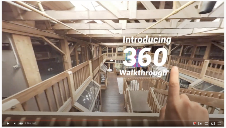 Screen 1: from DroneDeploy video above  Screen 2: from DroneDeploy video above 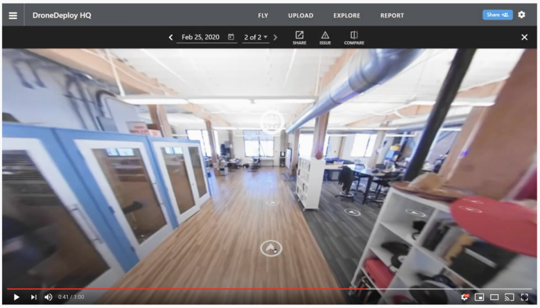 Screen 3: from DroneDeploy video above |
||
| Post 2 • IP flag post | ||
|
|
EaglePrecision private msg quote post Address this user | |
| More details extracted from the Conference session about this new product: - currently in beta - no announced GA date - must request access from account manager - Four recommended cameras to use: Insta360 ONE X and R, Ricoh Z1 & V - Strictly for video (must be uploaded as equirectangular view, 5.7K 25fps H.264 MP4) - 360 video is uploaded to DroneDeploy cloud: One video per floor (Note: DroneDeploy cloud app allows uploading of photos to have them stitched into a panorama - they have an excellent stitching engine) - Once uploaded, DroneDeploy app: - reconstructs the walkthrough onto drone map (preferably captured the same day) and/or previously uploaded floorplan - user manually aligns walkthrough start/end points to floorplan (unless control points were added, then app automatically aligns) - Available functionality: - Select any point on the walkthrough to view a 360 of that point; see other viewable points as hotspots - Annotate any spot on a 360 - Compare on same screen video with previous walkthrough and/or 360 image of a point with same from a previous walk-through - share link of the video or a 360 point of interest with annotations/notes Conclusion: Although this product is primarily targeted at Construction sites (DroneDeploy's primary market), I can envision some use cases for builders, developers and real estate. Also the thread re: 'Animated 360'. The question is whether they will include it in the standard Pro Plan, which is currently $149/mo, or the Business Plan (with many construction-related additional functions) which is $449/mo. |
||
| Post 3 • IP flag post | ||
|
WGAN Forum Founder and Advisor Atlanta, Georgia |
DanSmigrod private msg quote post Address this user | |
| @EaglePrecision Awesome! Awesome! Awesome! Thanks SO much for sharing the details. Could you imagine this solution for indoor capture in a house for sale? If not, what kind of indoor capture? Dan |
||
| Post 4 • IP flag post | ||
|
|
EaglePrecision private msg quote post Address this user | |
| I see the possibility for a high end property or estate where it would be combined with drone video and 360. Particularly for a large estate or farm where you might have multiple structures and client wants a map of the property. I'm working with a builder who has a model home across from a golf course and thinking of a use case for a drone 360 over the golf course, map overlapping the golf course and property and a walkthrough starting on the golf course through the front door and around the first floor. Then another walkthrough on the second floor which has a balcony overlooking the golf course. Of course, at sunset or sunrise. Duplicate the interior part of the walkthrough at another model of the same design with different features and staging for comparison. Another idea for the builder would be to show the different stages of construction with annotations highlighting quality features. For my senior living client who is about to renovate and construct, a walkthrough of the central amenities leading back to a model apartment - before and after. Just thinking - since you asked. I'm thinking of applying for access to the beta - just wondering if I'll have enough time. |
||
| Post 5 • IP flag post | ||
|
WGAN Forum Founder and Advisor Atlanta, Georgia |
DanSmigrod private msg quote post Address this user | |
| Video: SkyView360° Campus Tours by 360Pros HD | Video courtesy of 360Pros YouTube Channel | 25 July 2020 @EaglePrecision All sounds very exciting; including the fly-in through the front door. Please do keep us posted. Based on your post, the video above - indoor fly-through video - and this WGAN Forum discussions may be helpful: ✓ Virtual Tour Marketing Video of the Week: SkyView360 Dan |
||
| Post 6 • IP flag post | ||
 WGAN WGANStandard Member Los Angeles |
Home3D private msg quote post Address this user | |
| This is an interesting development. As a GeoCV user since 2018, I have used DroneDeploy to gather aerial photos which DroneDeploy's photogrammetry engine processed into what GeoCV referred to as their "Outdoor 3D Mode" (accessed by the 'tree' icon) This was the most striking and unique feature of GeoCV. It required careful use of 3rd party software (forget the name) to align the DroneDeploy model to the GeoCV indoor model / dollhouse, but it worked perfectly. Here's one example: This looks like DroneDeploy is stepping into the interiors 3D modeling business as well now, using 360video as the source of data to generate 360 walkthroughs. Will there be the capability of a "dollhouse" view of the interiors? I look forward to seeing where this goes. |
||
| Post 7 • IP flag post | ||

|
modularmind private msg quote post Address this user | |
| @Home3D Still a great feature. The software you were thinking of is Cloud Compare - https://support.geocv.com/hc/en-us/articles/360035101713-Adding-an-outdoor-3D-model |
||
| Post 8 • IP flag post | ||
Pages:
1This topic is archived. Start new topic?