


10 Things I learned shooting GSV of 3 Atlanta Parks with Labpano Pilot One12247
Pages:
1
 WGAN Forum WGAN ForumFounder and Advisor Atlanta, Georgia |
DanSmigrod private msg quote post Address this user | |
Video: How the Labpano Pilot One and GPS module connect is scary. While it was a "tight" connection when I began the two-hour shoot, this is the connection after the two hour shoot.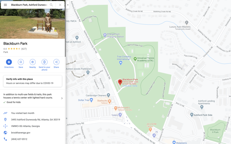 Screen Grab: Blackburn Park 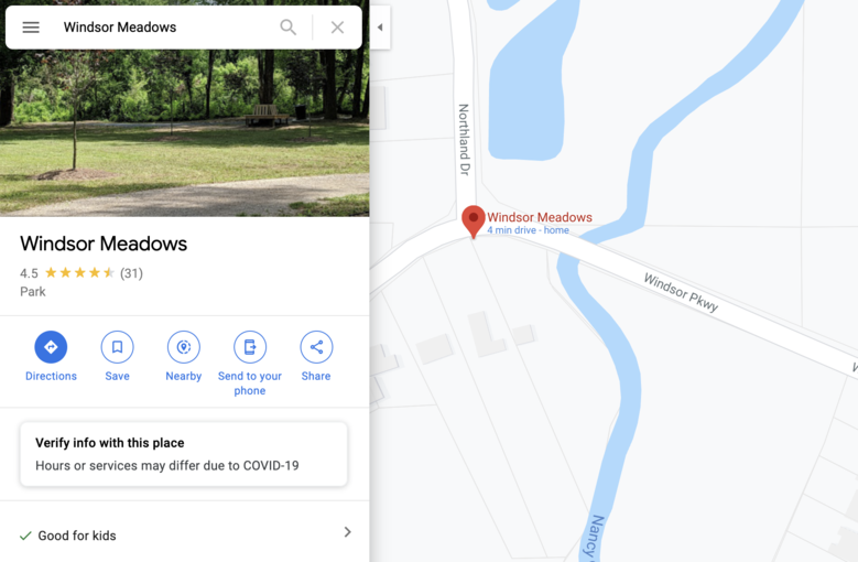 Screen Grab: Windsor Meadows 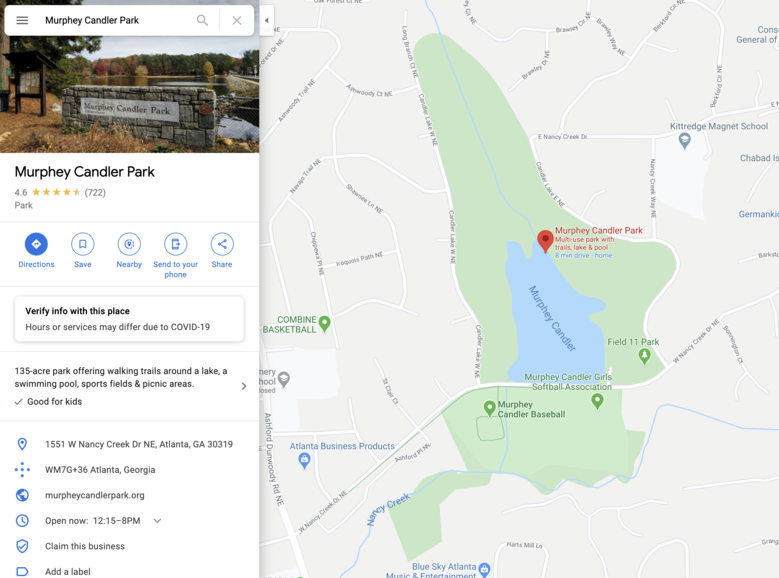 Screen Grab: Murphey Candler Park 10 Things I learned shooting GSV of 3 Atlanta Parks with Labpano Pilot One Hi All, Here are 10 things I learned using the Labpano Pilot One (128GB) + Labpano GPS Module for Pilot One – with this additional gear – to shoot Google Street View "Blue-Lines" of three Atlanta area parks yesterday (Sunday, 14 June 2020) and today. 1. Blackburn Park | Uploaded Sunday (14 June 2020): Waiting for GSV to show up on Google Maps 2. Windsor Meadows | Uploaded Sunday (14 June 2020): Waiting for GSV to show up on Google Maps 3. Murphey Candler Park | Shot Monday (15 June 2020): Still need to upload to GSV [First a warning: I would not use the Pilot One + GPS Module with a rooftop car mount or motor cycle (if I had one) because I would be afraid that the Pilot One and Pilot One GPS Module connection would break and that the Pilot One camera would be destroyed and might hurt someone.] Please see video above and this WGAN Forum discussion: GPS module for Pilot One has a poor design.] 10 Things I learned shooting GSV of 3 Atlanta Parks with Labpano Pilot One 1. It's super-easy to use the Labpano Pilot One to create Google Street View "Blue Lines" 2. The Labpano Pilot One Google Street View workflow is easy, fast and seamless 3. Using the Labpano Pilot Go iOS app to control the Pilot One is a great experience 4. I 5. Uploading to Google Sheet View (7 FPS 8K video) is super-easy (though it takes a long time; even with a fast WiFi) 6. When uploading to GSV, if the connection breaks, the reconnection pickup where it stopped. (Yay!) 7. Uploading to GSV includes pre-checked options for blur faces and blur license plates (Yay!) 8. It's easy to (also) upload directly from the Pilot One to: Dropbox, Google Drive and YouTube 9. How the Labpano Pilot One and Pilot One GPS module connect is scary. See video above. (Labpano is fixing!) 10. The battery lasted as expected (two hours). I also ran the fan continuously. Bonus: The selfie stick - included with this "backpack" - is hard to keep from collapsing (it did multiple times) Tips 1. Watch out for low branches (I hit one; then fell doing a forward "limbo" dance move) 2. Set the fan to continuous use (just seems like a best practice when scanning for two hours in the hot sun) 3. Bring a lens cleaning cloth with you I Am Confused On These Two Points 1. Do I need to turn on Gyro (or does that automatically default to on when shooting Google Street View)? (I did not turn it on: I may need to reshoot the three parks. We'll see when the GSV "Blue-Lines" get posted. 2. Do I need to set the focus to infinity ( or in the "middle" ) or does this automatically get set shooting GSV? Recommendations If you are going to sell Google Street View "Blue Line" creation and updates, get the Labpano Pilot Era instead of the Pilot One because the Pilot Era: 1. has the GPS module within the camera unit (avoids the challenges of the Pilot One + GPS Module connection) 2. 7200mAh removable high capacity battery (3.5 hours versus 2 hours with the Pilot One built-in battery 3. the Pilot Era mounted to a rooftop car mount will be a much safer experience than the Pilot One + Pilot One GPS unit Buy Now ✓ Labpano Pilot One (064GB) $1,199 | Buy from Labpano ✓ Labpano Pilot One (128GB) $1,249 | Buy from Labpano | Buy from Adorama ✓ Labpano Pilot One (512GB) $1,499 | Buy from Labpano ✓ Labpano Pilot One GPS Module | Buy from Labpano | Buy from Adorama ✓ Labpano Pilot Era (512GB) $2,799 | Buy from Labpano | Buy from Adorama Do you have questions about using the Labpano One One + Pilot One GPS Module to shoot Google Street View? Best, Dan P.S. Thanks to Labpano for sending me the Pilot One and Pilot One GPS module to beta test and to report about to the WGAN Community. |
||
| Post 1 • IP flag post | ||
|
WGAN Forum Founder and Advisor Atlanta, Georgia |
DanSmigrod private msg quote post Address this user | |
| [Placeholder for when the Google Street View Blue Lines appear on Google Maps.] | ||
| Post 2 • IP flag post | ||

|
TakedaSan private msg quote post Address this user | |
| Hi @DanSmigrod, Nice results. I have a suggestion for your tests. Can you try to update some street with existent blue lines, to see if your photos will update the old blue line on this street and put them on the history of Street View? Maybe using some kind of silver tape for security reasons Many thanks, Takeda IMG360 |
||
| Post 3 • IP flag post | ||
|
WGAN Forum Founder and Advisor Atlanta, Georgia |
DanSmigrod private msg quote post Address this user | |
| @TakedaSan Yes. I would like to do this. I do not understanding the following ... Quote: Originally Posted by TakedaSan Could you say that a different way? Dan |
||
| Post 4 • IP flag post | ||
 WGAN Fan WGAN FanClub Member Queensland, Australia |
Wingman private msg quote post Address this user | |
Quote:Originally Posted by TakedaSan I can tell you about it because I tested it with my blue lines plus read answers to similar questions on local guides connect. When you do an update for a blue line it goes to Timeline as a recent one. When a map user enters a GSV on a street you have just updated Google will only show their own blue line no matter how old it is. To see if there is a fresh one the user will need to change it in the timeline. However if the user uses the last blue line it remembers it for a specific street and next time the same user opens it they will see the last one. |
||
| Post 5 • IP flag post | ||
|
WGAN Forum Founder and Advisor Atlanta, Georgia |
DanSmigrod private msg quote post Address this user | |
| @Wingman Do you know the answers to the following? Quote: Originally Posted by @DanSmigrod Thanks, Dan |
||
| Post 6 • IP flag post | ||
|
|
TakedaSan private msg quote post Address this user | |
Quote:Originally Posted by DanSmigrod Hi @DanSmigrod, just a joke. Because you said that Labpano Pilot One and GPS module connect is scary, and you said you wouldn't use it on a rooftop car mount because it could be destroyed. So "connect" the camera and the GPS module with some kind of silver tape for "security reasons" 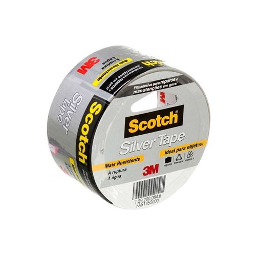 Quote: Originally Posted by Wingman Hi @Wingman, Can you share the link of this blue line with us, so we can see it? Because if this is the point I think it will be hard for us to convince someone to update the streets with the blue line. Many thanks! |
||
| Post 7 • IP flag post | ||
|
WGAN Forum Founder and Advisor Atlanta, Georgia |
DanSmigrod private msg quote post Address this user | |
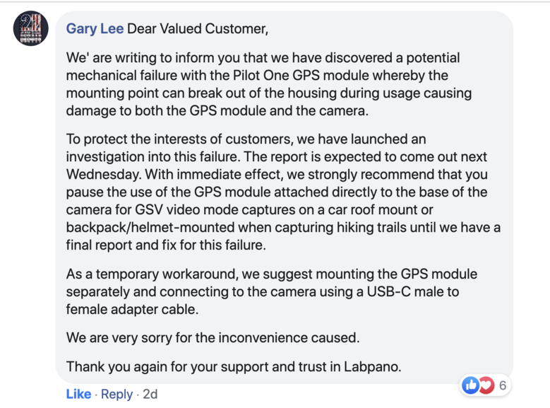 Screen Grab: Message from Labpano about its Pilot One GPS Module, as found in the Labpano Community on Facebook on Sunday, 14 June 2020. @TakedaSan Ah! Duct tape! Got it! (And, seriously consider using it! Plus, please see the message from Labpano about its Pilot One GPS Module, as found in the Labpano Community on Facebook on Sunday (14 June 2020) while I was outdoors using the Pilot One + Pilot One GPS Module. Yikes! Dan |
||
| Post 8 • IP flag post | ||
Pages:
1This topic is archived. Start new topic?