


Ricoh LiDAR Scanner to Enter Test Phase This Year18263
Pages:
1
 WGAN WGANStandard Member Osaka, Japan |
Meidansha private msg quote post Address this user | |
| It looks like Ricoh is working on a LiDAR Scanner similar to the Pro 3 and the prototype will enter the test phase this year. Ricoh is working on the device in conjunction with a major construction company in Japan. It scans a 5m radius and creates point cloud and 7k photographic imagery in 1 second. Ricoh is also working on an AI system to analyse the data and a viewer also. Article from the Nikkei news group in Japanese only. clickable text 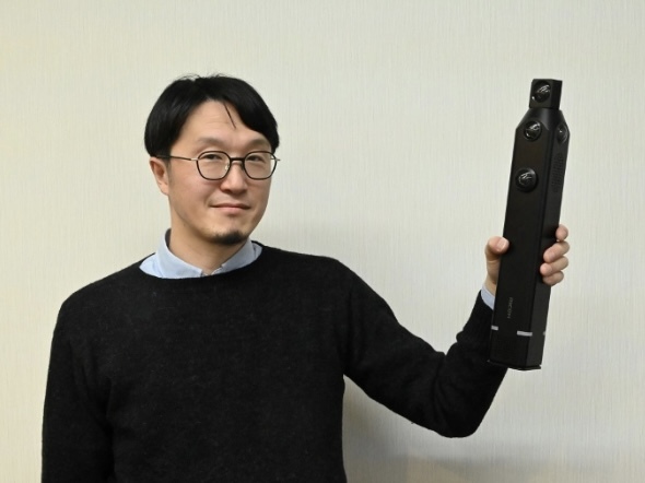 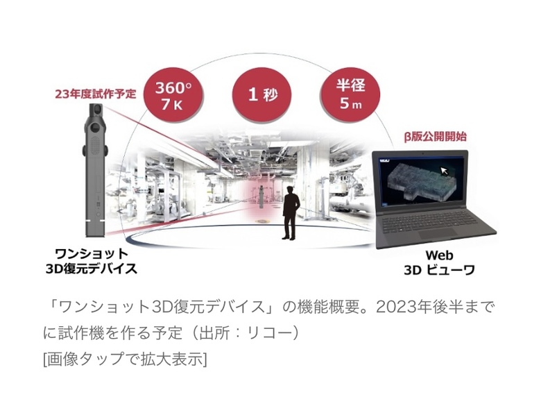 |
||
| Post 1 • IP flag post | ||

|
MeshImages private msg quote post Address this user | |
Quote:Originally Posted by Meidansha Thanks, very cool topic. Is there any English website on this (as I cannot identify the translate button  )? )? |
||
| Post 2 • IP flag post | ||
|
WGAN Standard Member Osaka, Japan |
Meidansha private msg quote post Address this user | |
| This was revealed on Thursday so you heard it on this forum first! I can’t find anything yet but I’m sure something will appear in the coming days. One important take away there will be a web based viewer for presentation purposes amongst other things like AI predictions of the building capacity and potential flow of people traffic inside. |
||
| Post 3 • IP flag post | ||
|
|
MeshImages private msg quote post Address this user | |
@Meidansha thanks a lot, sounds very interesting.  |
||
| Post 4 • IP flag post | ||
 WGAN Forum WGAN ForumFounder & WGAN-TV Podcast Host Atlanta, Georgia |
DanSmigrod private msg quote post Address this user | |
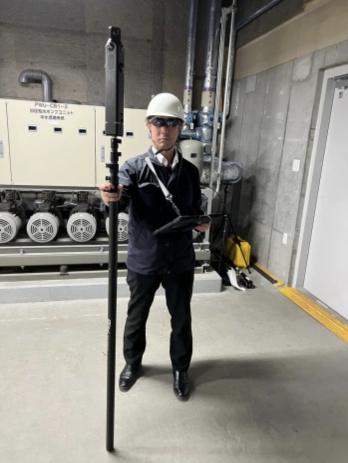 Image of using the One-Shot 3D Restoration Device (Photo: Ricoh) @Meidansha Thanks for sharing! From Google Translate of the first paragraph: Ricoh has developed a technology that acquires 360-degree point cloud and image data with a hand-held device. By making it possible to obtain 3D information of space more easily than general 3D laser scanners, we aim to utilize it at construction sites. We have already started joint experiments with a construction company, and plan to complete a prototype equipped with the developed technology by the second half of 2023. Source: Nikkei |
||
| Post 5 • IP flag post | ||
|
WGAN Forum Founder & WGAN-TV Podcast Host Atlanta, Georgia |
DanSmigrod private msg quote post Address this user | |
| @Meidansha @MeshImages I will be attending Geo Week in Denver the week of 20 February 2023. Perhaps Ricoh will be showing it off there?! Ricoh does have an existing 360 construction solution called RICOH360 Projects. (See this Ricoh link and select from the Solutions tab, RICOH360 Projects. Dan |
||
| Post 6 • IP flag post | ||
|
WGAN Standard Member Osaka, Japan |
Meidansha private msg quote post Address this user | |
| @DanSmigrod cool! Please take some photos if it is on display. Daniel Meidansha |
||
| Post 7 • IP flag post | ||
|
WGAN Forum Founder & WGAN-TV Podcast Host Atlanta, Georgia |
DanSmigrod private msg quote post Address this user | |
Quote:Originally Posted by Meidansha Will do! (And, video!) Thanks again for sharing this Ricoh meets construction news in the WGAN Forum. Dan |
||
| Post 8 • IP flag post | ||
 WGAN Standard WGAN StandardMember Las Vegas |
VTLV private msg quote post Address this user | |
| My Browser had a Translate. I'll read it later. Ricoh has developed a technology that acquires 360-degree point cloud and image data with a hand-held device. By making it possible to obtain 3D information of space more easily than general 3D laser scanners, we aim to utilize it at construction sites. We have already started joint experiments with a construction company, and plan to complete a prototype equipped with the developed technology by the second half of 2023. The prototype device "One-shot 3D reconstruction device" is small enough to be held in one hand and equipped with a light projecting device and a light receiving device. It shines light on an object within about 5m around the main body, measures the time it takes for the generated reflected wave to return, measures the distance, and acquires point cloud data in 1 second. By acquiring point cloud data of the indoor space at intervals of several meters, it automatically connects and reproduces the shape of the ground, walls, ceiling, and equipment in a three-dimensional digital space. It can also shoot 360-degree 7K images at the same time. A functional overview of the "one-shot 3D restoration device". Plans to build a prototype by the second half of 2023 (Source: Ricoh) [Click image to enlarge] General 3D laser scanners can acquire point cloud data with millimeter-level accuracy, but many of them take a long time to measure, are large, and cost several million yen per unit. In the prototype, the acquisition accuracy of the point cloud data is allowed to be several centimeters, and the operation speed is improved and the size and weight are reduced. The measurement range is as wide as 360 degrees. Some smartphone models are equipped with a LiDAR sensor that acquires point cloud data, but the measurement range is narrow, so it takes time and effort, and measurement omissions and omissions are likely to occur. It is envisioned to be used by attaching it to a monopod and acquiring 3D information of the space while walking and carrying it. Image of using the One-Shot 3D Restoration Device (Photo: Ricoh) Kenichiro Saisho, an expert at the Optical Data Stream PT of the Ricoh Advanced Technology Research Laboratories, who oversees the marketing and research and development of the point cloud data acquisition technology developed this time (Photo: Nikkei Cross Tech) [Click image to enlarge] In many construction management and equipment inspection sites, engineers generally consider confirmation procedures and transportation plans for materials and equipment based on two-dimensional drawings. Skilled technique is required. As labor shortages become more serious in the construction industry, there is a growing demand for technologies that enable even unskilled workers to appropriately acquire and organize spatial information on the job site. In parallel with the point cloud data acquisition technology, Ricoh will also develop a viewer for viewing 3D information and AI (artificial intelligence) for analysis. For example, AI can save labor in tasks such as counting specific equipment and linking it to a management ledger, and determining whether there are obstacles on the route when carrying large equipment in and out. The idea is to propose a service that can easily create and operate a "digital twin" of a site that changes daily. |
||
| Post 9 • IP flag post | ||
Pages:
1This topic is archived. Start new topic?